


Looking for an Epic Adventure in Nature? Then You’ll Want to Explore Hiking in Selangor
You can’t deny that there’s been at least one point in your life where you dreamt of having an epic adventure in the great outdoors.
Why not make it happen?
It’s no surprise that the iconic Batu Caves and famous malls like 1Utama and Sunway Pyramid often hog the limelight. But Selangor is also home to a number of lush, expansive trails and hidden gems you can experience. All without having to cross the oceans.
So get your hiking shoes or trail runners on, grab your backpack, pack some food and definitely lots of water because we’re going on an adventure beyond the cities of Kuala Lumpur and Selangor!
13 Hiking Trails in Selangor for an Epic Adventure in Nature

1. Bukit Broga, Semenyih (a.k.a Broga Hill)
Broga Hill is a well known hiking trail amongst hikers of all levels for its breathtaking views of the sunrise and panoramic views of Broga Town, oil palm plantations, rubber plantations, rainforest, distant hills, and more during clear days. It’s also known as Bukit Lalang for the local grass species that blankets the hill.
Broga Hill is home to a total of three peaks, but the first peak is the one you’ll want to explore as it has the most scenic views. The other two peaks are typically more for those who’d want to take on a trekking challenge.
The trail’s difficulty ranges from easy to moderate, with a mixture of steep pathways and flat, grassy paths that gradually slope.

Broga’s trailhead begins at the signboard which reads “Selamat Datang Ke Bukit Broga” which is located at the end of the on-site car park. Do note that you’ll have the option to park at the more popular private property which costs RM5 per pax, but this also gets you access to the private road uphill which is easier and wider to trek.
I highly recommend wearing long pants for the hike as the trail is covered by tall grass with sharp edges, along with proper hiking shoes with good grip as certain sections can get muddy and slippery during wet seasons.
Hiking Time: Approximately 1 hour
Elevation Gain: 375m
Opening Hours: 4am - 5pm, daily
Address: Jalan Broga, 43500 Semenyih, Selangor

2. Bukit Gasing, Petaling Jaya
Famous for its suspension bridge and watchtower, Bukit Gasing is a popular hiking spot nearby Kuala Lumpur for newbie and unfit hikers to get into hiking while experienced hikers train and maintain their fitness levels.
Bukit Gasing’s hike level lies between easy to moderate as its terrain alternates between flat to slightly slippery and steep trail. Steps are present so for an easier time hiking, and you have the option between the easy trail which takes up to 20 minutes to reach the famed suspension bridge, or a more challenging hiking trails that take up to 2 hours to complete.

The hiking trails for Bukit Gasing begins at the Gasing Hill Trail Entrance where the car park and public washrooms are located. Do note that limited parking lots are available so I’d advise coming early to start your trek at about 7am, or 3:30pm for the evening batch to ensure you get a parking space.
It tends to get crowded with hiking groups during weekends as it’s one of the easily accessible trails from Kuala Lumpur thanks to the Federal Highway. But this also makes it a safe option for you to hike if you intend to hike alone as a beginner, where you can take comfort in knowing that there are people around in case of emergencies on an unfamiliar trail.
Hiking Time: Between 20 minutes to 2 hours
Elevation Gain: 160m
Opening Hours: 24 hours, daily
Address: Bukit Gasing, 46000 Petaling Jaya, Selangor

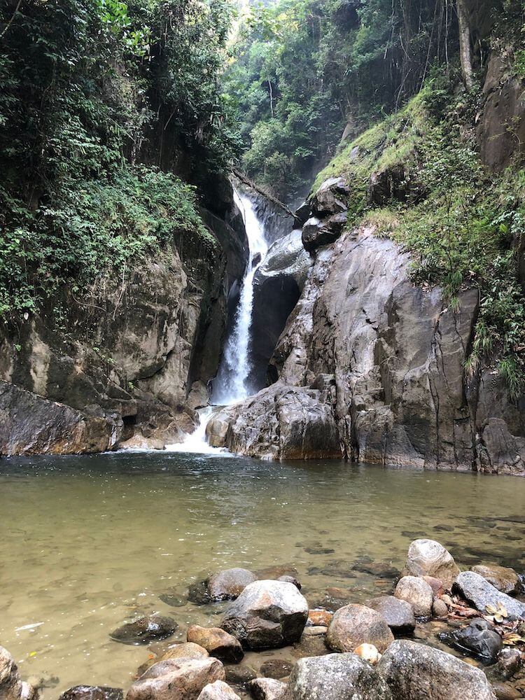
3. Chiling Waterfall, Kuala Kubu Bharu
What’s an adventure list without a waterfall destination? The Chiling Waterfall located near Fraser’s Hill is known fondly by locals as Selangor’s most beautiful waterfall. It’s an hour’s drive away from Kuala Lumpur and it is also the site of the Mahseer Fish Sanctuary managed by the Selangor Fisheries Department and Selangor Forestry Department.
The hiking trails leading up to Chiling Waterfall is an easy to moderate one that’s more suited for adventurous people as you WILL get wet before reaching the falls. You will first have to cross the river multiple times at each section where the river’s water levels can rise up to your waist.

It’s less of a hike as the terrain is mostly flat, but it still poses a challenge as you have to walk through running water that spans up to 2 hours before you reach the waterfall. But you’ll find that it was worth it all once you reach the waterfall and experience the cool, cascading waters. You can also see fishes in the clear waters, pitcher plants, and Malaysia’s famed Raja Brooke Birdwing butterfly throughout the trek.
Chiling Waterfall’s trailhead is at the entrance by the road from Kuala Kubu Bharu to Fraser’s Hill. You can access it by first passing the Selangor Dam and Reservoir, then crossing a small steel bridge over the Chiling River to reach the car park and trail’s entrance. Note that there is an entrance fee of RM1 per person and fishing is not allowed.
Hiking Time: Up to 2 hours
Elevation Gain: 553m
Opening Hours: 8am - 6pm, Saturday and Sunday only. Close during public holidays.
Address: Chiling Waterfalls, 44000 Kuala Kubu Bharu, Selangor

4. Bukit Ah Pek (a.k.a Bukit Putih), Cheras
Bukit Ah Pek is officially known as Bukit Putih, and it borders on the Selangor side of Cheras. It features a full loop trail running between Bukit Saga and Ah Pek Hill and it is located right beside Ketumbar Hill, another popular hiking spot that is known for the wild boars that populate the area.
It’s home to various hiking trails that lead to waterfalls like the Bukit Saga Waterfall which connects both Ah Pek Hill and Bukit Saga all the way to Taman Saga, and multiple stations with one of it being the popular “Tea Station” with exercise equipment available and a snack store.

Because of the number of trails available, the difficulty of the overall hike ranges from moderate to challenging. There are short trails for beginners and long trails that take up to a day to conquer even for veteran hikers.
The trails are notably steep with some slippery spots and rocky paths, get ready for some challenging climbs and come prepared with appropriate hiking shoes.
Ah Pek Hill’s trailhead begins at one of its many entrances, with the most popular one being listed on Google Maps/Waze as the “Apek Hill Car Park”. Here’s where most hikers park their car near the 99 Speedmart parking lots to avoid disrupting the daily lives of residents nearby.
Beware of leeches on the Bukit Ah Pek - Bukit Saga trail loop during wet season and at the riverside. I’d recommend applying some eucalyptus spray all over your body as it’s known to keep those pesky buggers away. Don’t forget packets of salt to get them off you too!

Since it’s a challenging trail, I’d also recommend wearing proper hiking shoes over trail runners and bringing up to 2L of water or your favorite thirst quencher in the Montigo Ace Bottle Massive to make the hike an enjoyable one.
Hiking Time: 5 hours on average
Elevation Gain: 486m
Opening Hours: 7:30am - 5pm, daily
Address: One, Persiaran Asana, One Legend, 43200, Cheras, Selangor

5. Bukit Kutu, Kuala Kubu Bharu
Once known as a colonial hill station called “Treacher’s Hill”, Bukit Kutu is now a popular climbing spot on weekends for veteran hikers. This hill is famed for its stunning panoramic view of the Titiwangsa mountain range and Kuala Kubu Bharu Dam at the summit.
It’s generally regarded by veteran hikers as a challenging out-and-back trail that spans up to 10.5km. This place is also one of the locations that require a permit from the local authorities before you can hike it, or face a fine up to RM30,000 if you get caught without a permit.
Bukit Kutu’s terrain is typically uphill which can get muddy, with small rivers you’ll have to cross (yes, there are leeches so come prepared). So be prepared to get your shoes soaked. You’ll also find thickets of bamboo trees and boulder paths that have to be climbed via the metal ladders placed there.
The Bukit Kutu trailhead begins at Kampung Pertak, an orang asli village at foothills, which is also where you can park. I’d recommend bringing an extra change of clothes so you can enjoy a short splash at the on-site stream, dry food like sandwiches, onigiri, or energy bars for a brief lunch break and up to 2L of water to stay hydrated on the trek.
Hiking Time: Up to 6 hours
Elevation Gain: 1053m
Opening Hours: 24 hours, daily
Address: Bukit Kutu, Kuala Kubu Bharu, Selangor

6. Gunung Nuang, Hulu Langat
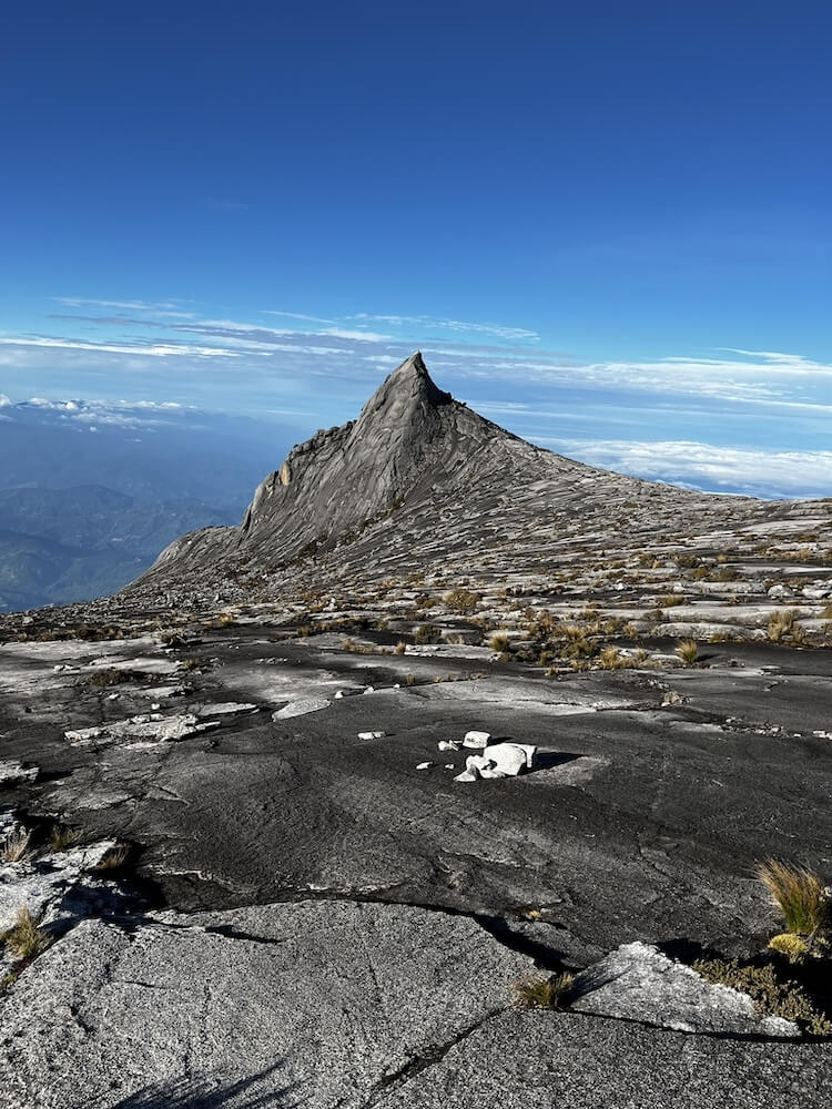
Gunung Nuang is the third highest peak in Selangor right after Gunung Semangkuk and Gunung Ulu Kali. It’s one of West Malaysia’s most challenging hiking trails that veteran hikers attempt as part of their training before scaling Mount Kinabalu.
The 17.9km trail’s terrain includes a mixture of steep, rugged and narrow pathways with highly steep drop-offs. Not forgetting strenuous climbs up rocks and exposed tree roots, making it quite a challenging hike even for veterans.
You’ll need a permit to hike Gunung Nuang, and rightfully so because of how treacherous the trail can be for inexperienced hikers.
Gunung Nuang’s trail begins at Kampung Pungsun where you can park your car and register with the local ranger. You’ll need to be prepared with ample dry food, granola bars, sandwiches, or onigiri and no less than 2L water because of the sheer length of the hike.
Hiking Time: Up to 13 hours
Elevation Gain: 1492m
Opening Hours: 24 hours, daily
Address: Gunung Nuang Recreational Forest, Kampung Pungsun, Hulu Langat, Selangor, Malaysia

7. Kota Damansara Community Forest Reserve (KDCF)
If you’ve been looking for hiking trails with mostly flat terrain, then you’ll be happy to discover the Kota Damansara Community Forest Reserve (KDCF).
KDCF is known as the green lung of Kota Damansara and it’s a community-managed low land forest that occupies almost half of Kota Damansara at 321.7 hectares, with a small entrance fee of RM2 per adult and RM1 per child.
The hiking trails run between easy to moderate because of its flat terrain, with challenging parts only at the steep pathways near the Tiga Puteri Peak. There are no stairs, but the gentle elevation makes it an overall easy trail.
Monkeys are abundant in this hiking spot so steer clear of them and remember the general rule of thumb: do not feed, provoke, or stare at them.
You can park at the shops nearby with 7-Eleven as the landmark, then take a leisure 10 - 15 minutes walk to KDCF’s entrance.
Hiking Time: Up to 4 hours
Elevation Gain: 289m
Opening Hours: 7am - 3pm, daily
Address: Jalan Merbah 10/1, Seksyen 10 Kota Damansara, 47810 Petaling Jaya, Selangor

8. Bukit Chenuang, Hulu Langat
Not to be confused with Gunung Nuang, Bukit Chenuang is also one of Selangor’s extremely challenging trails that Mount Kinabalu climbers utilise as their training ground.
The Bukit Chenuang hike spans up to 9.5km where fallen trees that litter the trail and bamboo thickets are abundant. While the forest’s density offers ample shade, it also causes leeches to make their home here due to the shaded and damp nature of the forest.
The terrain tends to be slippery so hiking shoes with proper grip are a must, and you’ll need a permit to hike here. Don’t forget to pack enough food and water to keep your energy levels up as it will be a long hike.
Bukit Chenuang’s trailhead begins at the entrance of Sungai Congkak, which is also where you can park your car with an RM5 parking fee.
Hiking Time: Up to 4 hours
Elevation Gain: 669m
Opening Hours: 24 hours, daily
Address: Bukit Chenuang, 43100, Hulu Langat, Selangor

9. Lata Medang, Kuala Kubu Bharu
Lata Medang’s trail features two stunning waterfalls, making it such a scenic route for waterfall hunters. It’s known for its crystal clear torrents of water and tall waterfall cascade because it isn’t frequented by thralls of visitors unlike the Kanching Forest Waterfall (also because you need a permit to hike here).
The trail here is moderately challenging with mostly flat, but incredibly expansive terrain that spans up to 7.3km so be prepared to spend up to 4 hours hiking. A few slopes are present along the way but they don’t incline beyond 45 degrees, making it easy on the knees.
The only challenging part involves crossing the collapsed iron bridge, or wading through the river which is sometimes teeming with leeches at the shallow parts.

Lata Medang’s trail begins similarly to Bukit Kutu in that you’ll begin at Kampung Pertak, so just Waze/Maps there to find a parking spot. You’ll need to pay an RM1/pax entry and parking fee to the local orang asli who are also the land’s caretakers.
What makes Lata Medang a pleasant hike are the friendly stray dogs roaming about the area, so bring a pack or two of doggie treats to treat the little good boys. ;)
Hiking Time: Up to 4 hours
Elevation Gain: 671m
Opening Hours: 24 hours, daily
Address: Lata Medang, Kuala Kubu Baru, Selangor, 44000

10. Kanching Forest Waterfall, Templer Park, Rawang
Located deep within Taman Eko Rimba Kanching, the Kanching Forest Waterfall trail is famous amongst hikers and picnickers for its multi-tiered waterfall, swimming pond, and expansive forest reserve.
There are 7 tiers of waterfall trails that go up to 2.1km with rising difficulty levels at each tier, putting this trail’s difficulty from easy to challenging.

The terrain starts off simple with paved walkways and stairs at the lower levels, while more experienced hikers can expect steep and rocky terrain with no pavements or steps at the upper levels.
Expect to pay an RM3/adult entry fee and RM5 parking fee at the trailhead which begins at Templer Park.
You’ll also spot monkeys and the occasional wild cats frolicking about the trail, with food and drink stalls available during weekends so you don’t have to pack food if you’d like to travel light.
Hiking Time: Up to 2 hours
Elevation Gain: 216m
Opening Hours: 6am - 8pm, daily
Address: Taman Eko Rimba Kanching Templer's Park Jungle Waterfall, 1, Rawang, Selangor, Malaysia

11. Bukit Sapu Tangan, Mirror Lake Trail, Shah Alam
Bukit Sapu Tangan is home to the majestic Mirror Lake, and it is accessible from the Shah Alam Botanical Gardens. It’s a popular training spot for mountain bikers so you can expect to see a number of them on this 8.4km trail.
Here, you’ll trek through a mixture of steep inclines and jungle trails, so expect dense foliage, some fallen trees else branches, rocks, and overgrown roots as you venture deeper within on the path to the Mirror Lake.
It takes up to half a day to complete the hike depending on which trail you opt for and how many trails you’d like to complete in a day, making this an overall moderate to challenging hike.
The trailhead begins at the Shah Alam Botanical Gardens parking lot where you will be greeted by the tarred path that leads to Puncak Seni, then the Mirror Lake.
Hiking Time: Up to 6 hours
Elevation Gain: 450m
Opening Hours: 8am - 5pm, Tuesday to Sunday. Closed on Mondays
Address: Taman Botani Negara Shah Alam, Shah Alam, 40000 Shah Alam, Selangor

12. Gunung Semangkuk (Pine Tree Hill & Twin Peak Trail), Fraser Hill
Known as Selangor’s highest peak that also borders Pahang, Gunung Semangkuk is an incredibly difficult trail that requires a permit, and sometimes a guide to tag along as you scale its trails.
The trail goes up to 27km to and fro, with experienced hikers coming here to train before they scale Mount Kinabalu. It starts off with gentle slopes, then escalates to steep inclines and vertical climbs that can only be scaled using ropes - it's definitely not a common trail.
The trail leads to one of the first summits, known as the beautiful Pine Tree Hill where hikers are rewarded with a breathtaking panoramic view of majestic mountains, telecommunication towers, and settlements on a clear day.
After Pine Tree Hill, hikers can continue on to the Twin Peak with a slightly lower elevation. Because of its extensive length, it’s common for hikers to set up camp at Sungai Merah Campsite for the night before continuing onwards to the final summit of Gunung Semangkuk.
Be wary as there are reports of poisonous snakes, scorpions, leeches, centipedes, and bees that make their home on the mountain.
Hiking Time: Up to 20 hours
Elevation Gain: 1825m
Opening Hours: 24 hours, daily
Address: Gunung Semangko, Fraser’s Hill, Selangor

13. Bukit Jugra, Kuala Langat
Bukit Jugra was previously the royal capital of Selangor back in the late 1800’s. Today, it’s a popular spot amongst outdoor enthusiasts because of the adventurous activities it offers; namely hiking and paragliding. It’s also a hidden gem where one can enjoy a panoramic view of the Straits of Malacca, old-world architecture, and the popular local delicacy - “Beggar’s Chicken”.
I’d recommend starting your trek up Bukit Jugra from Masjid Al-Muttaqin in Kampung Permatang Pasir, which leads you into a lush jungle where you’ll pass the Jugra Lighthouse before reaching the summit.
Take note that the 6.8km trail can get muddy and wet especially during rainy seasons, which also means leeches.
Hiking Time: Up to 2 hours
Elevation Gain: 245m
Opening Hours: 24 hours, daily
Address: Bukit Jugra, Jugra, 42700 Banting, Selangor