


Hiking Kelantan 101: Exciting Hiking Trails To Explore In Northeastern Malaysia
Looking for a new challenge after you've conquered the hiking trails in Pahang and Negeri Sembilan? Then you'll want to check out the hiking trails of Peninsular Malaysia's northeastern state, Kelantan!
A few things typically come to mind when Malaysians think of Kelantan, such as kite flying activities involving the traditional wau bulan, a childhood game of gasing (spinning tops), and wayang kulit (shadow theatre plays). These are but some of the reasons that led to this state's monicker as the "cradle of Malay culture".
But other than cultural arts and craft, and of course the local cuisine, Kelantan has a whole lot to offer when it comes to its nature and terrain. There are several peaks just waiting for hikers to conquer, each surrounded by lush greenery, wild jungles, and crisp fresh air away from pollution often faced by large cities.
So, are you ready to experience a proper adventure in the great outdoors of Kelantan? Get your hiking essentials packed, and your comfiest hiking shoes laced up because we're going to challenge the hiking trails of Kelantan and enjoy the breathtaking sights offered by its peaks!
7 Breathtaking Hiking Trails To Check Out In Negeri Kelantan
1. Bukit Panau
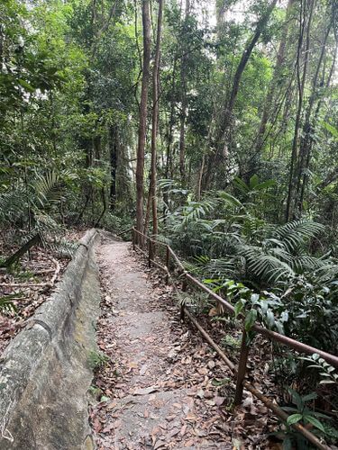
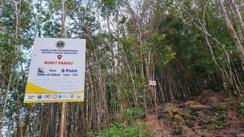
If you are on the hunt for a beginner-friendly trail to improve your hiking stamina, Bukit Panau is just the hiking adventure you are looking for.
Even though this hiking trail boasts a relatively simple trek, it's best to begin your hike around 7am or earlier to avoid the brunt of the sun at its semi-barren peak. Or you could just wear a hat to protect yourself against the heat (I'm looking at you night owls).
You'll encounter two ways to the peak at the beginning - the paved road (some call it the TM way) or the jungle trek. Both paths are a little steep going uphill but it is a manageable type of incline. I'd recommend using a hiking stick if your knees aren't trained to withstand the incline to make this hike a little easier.
Once you spot the transmitter station along the way, you will know that you are almost at the peak! From then on, it will take you up to 30 minutes to ascend to the peak depending on your fitness level.
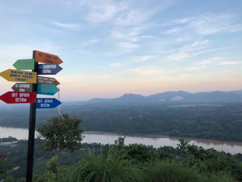
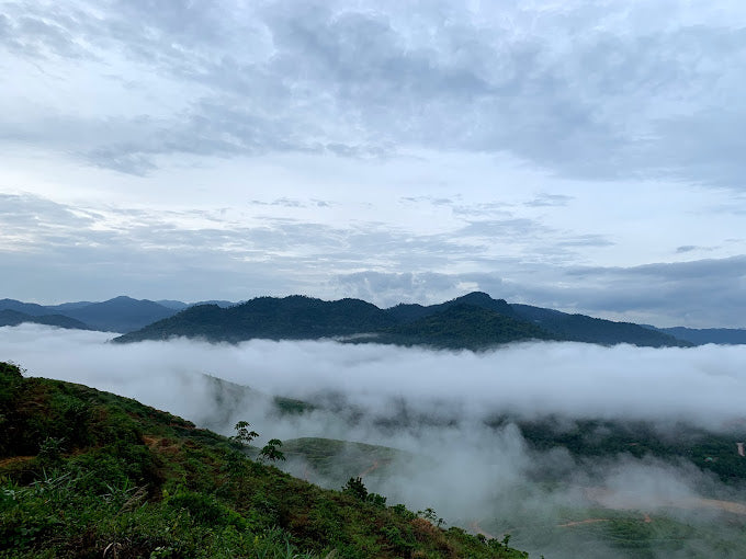
If you're lucky and there on a clear day, you can see the majestic Sungai Kelantan along with views of the Pasir Mas town in the Pasir Mas district of Kelantan, and the Tanah Merah district of kelantan. Otherwise, the next best alternative would be the beautiful awan karpet (sea of clouds) at the peak of Bukit Panau. During the weekends, you may come across stalls at the peak that sell snacks and drinks for you to enjoy over a brief picnic as you take a break and absorb the breathtaking sights.
Some believe that Bukit Panau is where the legendary Laksamana Hang Tuah practised his silat skills. So if you are a history aficionado, don't forget to check out this place while you get your workout done for the day!
Entry Fee: Free
Hiking Time: 1 hour
Trail Distance: 2.1km
Elevation Gain: 186m
Address: Jalan Pasir Mas - Tanah Merah, 17040 Pasir Mas, Kelantan, Malaysia
2. Bukit Salor
Bukit Salor's hiking trail is a favourite among locals. It is suitable for beginners, which makes it easy for those who are new to hiking to trek and enjoy stunning sights from the peaks.
Bukit Salor has two peaks where hikers can enjoy a brief respite. The first viewpoint is where you will see the iconic "I Love Bukit Salor" signage. To reach the first of the two peaks, you'll want to hike through the paved trail which will take you about 20 minutes.
To reach the second viewpoint, continue hiking on for 15 to 20 minutes on the unpaved trail. If you start hiking early around 6:30am, you may get to admire the lovely sea of clouds from this vantage point. You will also get to enjoy a bird's eye view of the surrounding villages and Gunung Reng.
That said, Bukit Salor is an open area with few trees around so I'd recommend starting your trek through the peaks early morning to avoid the brunt of the sun. Should you head there early in the morning, don't forget to bring a torchlight or headlamp as it can get pretty dark there without streetlights.
Entry Fee: Free
Hiking Time: 1 hour
Address: Bukit Salor, 17600 Jeli, Kelantan, Malaysia

3. Mount Yong Yap
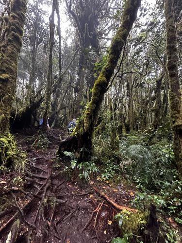
If you are looking for a challenge, why not consider Mount Yong Yap? Mount Yong Yap is one of the Great Seven (G7) mountains of Malaysia, standing tall as the 6th highest peak. It is common for hikers to undertake a 2-day-1-night hike up Mount Yong Yap because of how challenging and lengthy the trek is.
There are two routes to hike Mount Yong Yap. The first route that begins at Kuala Mu will require someone to drive you to the entrance via a 4-wheeler. On the other hand, the second route starts at Pos Renggil, which is relatively more challenging than Kuala Mu.
The trek to the peak is rather demanding because parts of the trail are incredibly muddy, which makes it slippery. Therefore, a good pair of hiking shoes is necessary for the ascent up Mount Yong Yap. Besides, you need to cross a few rivers throughout the routes, so don't forget to bring extra socks.
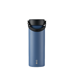
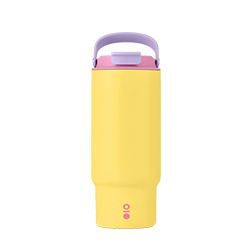
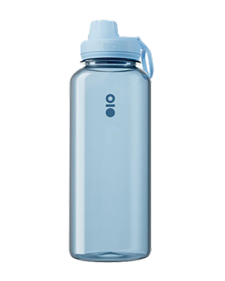
There are many sandflies at the campsite, so insect repellent is a must, along with a reusable water bottle, preferably one that keeps drinks cool for hours just like the Montigo water bottle, because you can get refills and stay hydrated along the way through its many water stations!
Even though it's a real challenge to get to the peak, it will all be worth it when you can finally enjoy the scenery from the top. You will need a permit and a guide to lead you up Mount Yong Yap as there is a chance of running into wild animals.
Entry Fee: RM5 (locals), RM30 (foreigners)
Hiking Time: 2 days and 1 night (1-day hike is possible but highly challenging)
Trail Distance: 17.4km (via Kuala Mu), 39.6km (via Pos Renggil)
Elevation Gain: 1,671 m (Kuala Mu), 2,151 m (Pos Renggil)
4. Mount Yong Belar
If you plan to conquer all mountains on the G7 list, Mount Yong Belar is a must, which borders Kelantan and Perak. Before you start hiking, take note that you need to obtain a permit to hike Mount Yong Belar.
While it's possible to conquer Mount Yong Belar in a day, most prefer to take things easy by opting for a 2-day-1-night hike.
There are two ways to reach the entrance to the forest, which is called Pintu Rimba. The first way is to climb the cement steps and follow the water pipes from Blue Valley Dam until you reach the vegetable farm, where you will walk a distance until you arrive at Pintu Rimba.
The other way is to hire a 4-wheeler to pick you up from Masjid Lojing to take you to the vegetable farm, which will save you some time and effort.
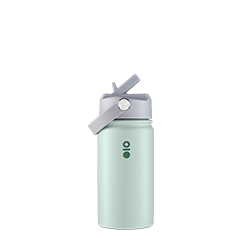
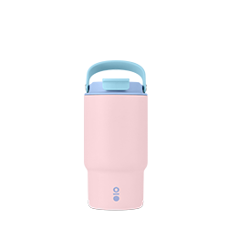
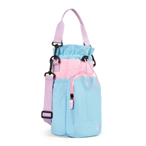
Along the way, you will encounter multiple fake peaks before you reach the actual peak. In fact, the trail does get rather muddy so a good pair of hiking shoes is a must to ease your climb over the standard pair of trail runners. You'll also want to pack ample water up to 2L to stay hydrated throughout the challenging hike, which makes the Montigo Ace Bottle Massive just the right companion.
If you are lucky enough to arrive at its flat peak on a clear day, you can spot the other peaks that surround Mount Yong Belar. Depending on the weather, it could measure as low as 12°C at the peak, so you may want to bring along your jacket.
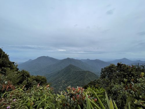
If you are looking for a chance to get an excellent view, it's best to go for a 2-day-1-night hike because the view looks best early in the morning. On a clear day, you might be able to spot Gunung Yong Yap, Gunung Korbu, Gunung Bubu, and more!
Another reason to camp overnight is due to the multiple steep slopes that go up and downhill, which will be tough on your knees. Hence, camping overnight allows you to go at a slower pace. But if you'd like to take on the challenge in a day, do bring a hiking stick or two to lessen the burden on your knees.
Entry Fee: RM5 (locals), RM30 (foreigners)
Hiking Time: 2 days and 1 night (or 12 to 14 hours for a 1-day hike)
Trail Distance: 13km
Elevation Gain: 1,031m
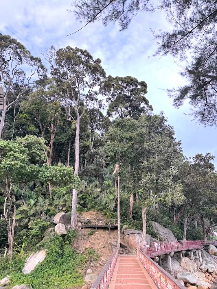
5. Jelawang Waterfall
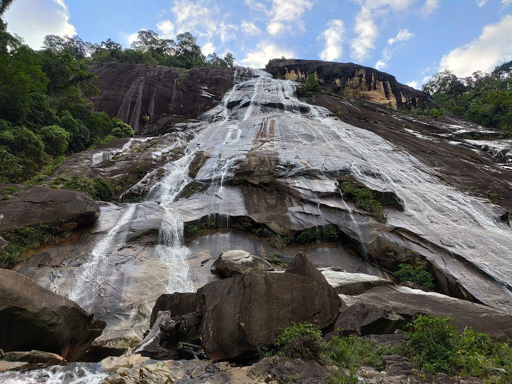
The majestic Jelawang Waterfall stands proudly as one of Southeast Asia's tallest waterfalls. It is also known as the Stong Waterfall, which is located at Gunung Stong State Park.
Accommodation is available at Gunung Stong State Park for those seeking a proper exploration, but you can camp at the Baha Campsite near the waterfall's highest point. If a full exploration is not part of your plans, you can also opt for a day hike to the falls.
Upon entering Gunung Stong State Park, head for the series of cement steps that leads you to the foot of the Jelawang Waterfall. If you are looking for a great spot to take photos of the waterfall, the bridge in front of the waterfalls is a great option!
Should you wish to head to Baha Camp at the top of the waterfall, you must hire a guide for a fee to lead the way. It's a rather steep hike to Baha Camp, but it'll all be worth it once you see the stunning sights.
Leeches have been sighted at Jelawang Waterfall, so remember to wear your anti-leech socks. If you have a drone, it's a great way to take lots of videos of the waterfall! But be careful of where you step as there have been dangerous incidents of hikers falling off the waterfall.
Hiking Time: 2 hours
Trail Distance: 3.2km
Elevation Gain: 370m
Opening Hours: 24 hours, daily
Address: Kampung Jelawang, 18200, Dabong, Kelantan

6. Gunung Stong State Park
Gunung Stong State Park has a few peaks for you adventurous hikers! There is Gunung Stong, Gunung Ayam, and Gunung Baha for you to choose from. You will need a permit and a guide to hike these mountains.
To get to Gunung Stong State Park, you can either drive or take an overnight train via KTM to the train station at Dabong and arrange for someone (your guide if you arrange ahead of time) to pick you up. The state park provides accommodation and guide services for you to hire to lead you up these mountains.
Regardless of which peak you plan to conquer, you will be camping overnight at Baha Camp, which is located at the top of Jelawang Waterfall. It'll take you about 1.5 hours from the park to reach Baha Camp. Then, you will spend the next day hiking to the top of one of the three mountains and returning to camp.
Overall, hiking at Gunung Stong State Park is best attempted by experienced hikers due to its challenging settings. As the trails are pretty muddy and steep, a good pair of hiking boots is a must to make it easier for you to hike.
If you'd like to extend your adventurous streak, you may consider exploring the caves near Dabong town!
Entry Fee (excluding fee for guides): RM3 (Malaysians), RM10 (Non-Malaysians)
Opening Hours: 24 hours, daily
Address: Kampung Jelawang, 18200, Dabong, Kelantan, Malaysia

7. Bukit Kwong
If you are looking for a family-friendly hiking trail, Bukit Kwong is the place you are looking for.
There are two trails at Bukit Kwong. The more difficult trail is the jungle trail, while the easier trail is an unpaved path that starts off in an area surrounded by oil palm trees.
Hikers who want to experience the best of both worlds (or in this case, trails) can take the unpaved path up to the peak and descend Bukit Kwong via the jungle trail.
You will enjoy a unique view from the peak. This is where you will see the famous Bukit Kwong Dam and the border between Malaysia and Thailand!
Hiking Time: 1 hour 11 minutes
Trail Distance: 2.1km
Elevation Gain: 232m
Address: Padang Bukit, 17200 Pasir Mas, Kelantan, Malaysia