


Hiking Melaka 101: Check Out Melaka's Top Scenic Hiking Trails For Your Next Outdoor Adventure
When Malaysians think of Melaka (or Malacca), we think of the awesome local restaurants selling delicious chicken rice balls, cendol gula melaka, Nyonya food, Jonker Street, Christ Church, and A Famosa!
But did you know that Melaka city has its share of scenic hiking trails for you that will ignite your adventurous spirit?
Imagine starting your Sunday with a hike at one of Melaka's lovely hills like the iconic Bear Hill and ending it on a good note at your favourite restaurant or cafe!
If that sounds like an exciting plan, get your hiking essentials ready. We're going to explore the hiking trails of Melaka for an epic trip of food, adventure, and nature!
9 Best Hiking Trails Of Malacca To Explore (Complete With Tough Hikes For The Experts Among Us Too!)
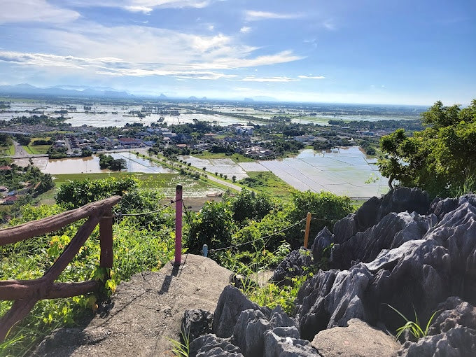
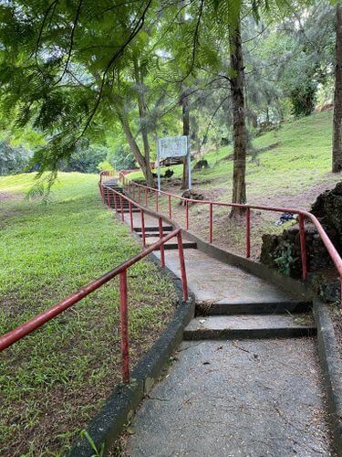
1. Bukit Beruang Melaka (Bear Hill)
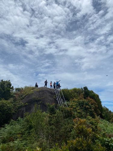
Bukit Beruang, is known as Bear Hill in English. Sounds super cute, doesn't it? But don't be fooled by its cute name! While Bukit Beruang offers hikers a dazzling scenery from the peak, some of its hiking trails boast a moderately challenging to highly difficult climb to the top!
Several hiking trails line the way to the peak of Bear Hill, including tarred roads and unpaved jungle trails. The trails that promise higher intensity include steep slopes and rugged dirt paths. If this is your first time and you're worried about getting lost, I'd advise taking the tarred main road (also known as the Telekom way) to the peak of Bukit Beruang or embark on the hike with a local who is familiar with the hiking trails.
Nevertheless, your hard work and effort will be all worth upon reaching the hilltop of Bukit Beruang. You will be rewarded by the panoramic scenery of Malacca's historical beauty that will leave you breathless and in awe.
If you are feeling a little adventurous, you can attempt the mini rock climbing area at the peak. Don't worry too much when it comes to safety as there are ropes to help you ascend this area with ease. But that said, do attempt the climb with proper gear and a friend or two in place just to be safe!
Hiking Time: 1 hour 40 minutes
Trail Distance: 3.9km
Elevation Gain: 277m
Address: Bukit Beruang, 75450, Malacca, Malaysia
2. Bukit China (China Hill)
Looking for a beginner-friendly trail to build up your hiking stamina? Bukit China is a great place for you to start.
Bukit China serves as a quick and free escape from the hustle and bustle of town, where you can go walking or jogging among the lush greenery of Malacca. In fact, it is also a location that has been of historical significance to Malacca for centuries. It is home to the largest Chinese cemetery outside of China with over 12,000 tombs on site and the occasional temple sightings, partly due to Malacca's war history.
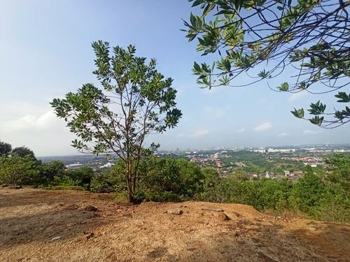
Since this is a beginner-friendly trail, you can expect an easy and pleasant walk up the stairs to the peak, which offers two contrasting sceneries. On one side, you can admire the view of urban Malacca, where you can even spot the Straits of Malacca in the distance on a clear day. The other side offers a view of Malacca's rural setting with blankets of greenery.
One popular spot here is the Hang Li Po Well, which was said to be used exclusively by Princess Hang Li Po from the Ming dynasty of China during the days of the Malacca Sultanate according to historical accounts. Now, the locals consider it as a wishing well!
Hiking Time: 40 minutes
Trail Distance: 2.7km
Elevation Gain: 51m
Opening Hours: 24 hours, daily
Address: Bukit China, 75100, Malacca, Malaysia
3. Tangga Taubat
Tangga Taubat means "Stairs of Repentance" when translated into English. This flight of stairs is part of the Pulau Intan trail, one of the trails of Hutan Simpan Tanjung Tuan which borders the neighbouring state of Negeri Sembilan.
While this is considered a short route, it is also rather challenging as the path consists of Tangga Taubat's renowned steep and slippery steps. Which is why I'd recommend wearing shoes that provide a firm and good grip to maintain your balance and stay safe along the ascent.
To begin your hike, take the tarmac road that begins at the car park until you spot the iconic Cape Rachado Lighthouse of Malacca. You will climb a short flight of steps to Rumah Api Tanjung Tuan, which is the local's name for the Cape Rachado Lighthouse. From then on, keep an eye out for the Tangga Taubat towards the back of the lighthouse, which will lead you to Tanjung Tuan's beach.

The water by the coast is one of the clearer ones around, making it perfect for a swim so don't forget to pack a change of clothing if you decide to take a refreshing dip. It's also a good place for a brief picnic before continuing the hike up the stairs to the lighthouse. Here's where an icy cold drink in the Montigo Ace Bottle will come in handy to stay hydrated before embarking on more steps!
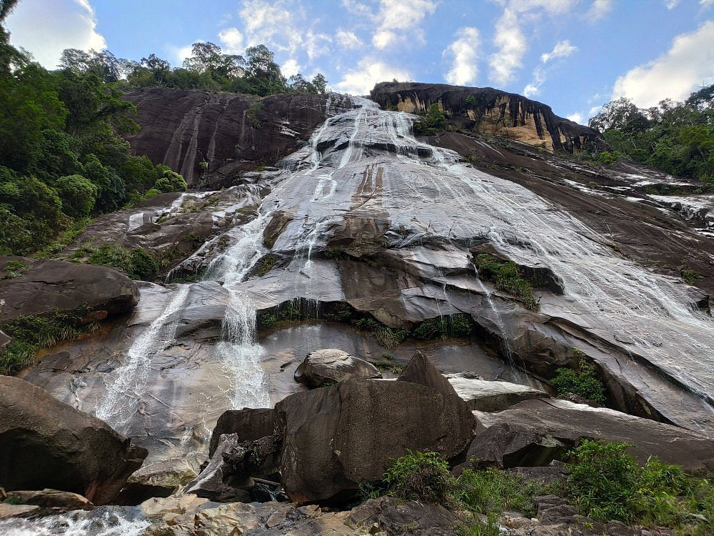
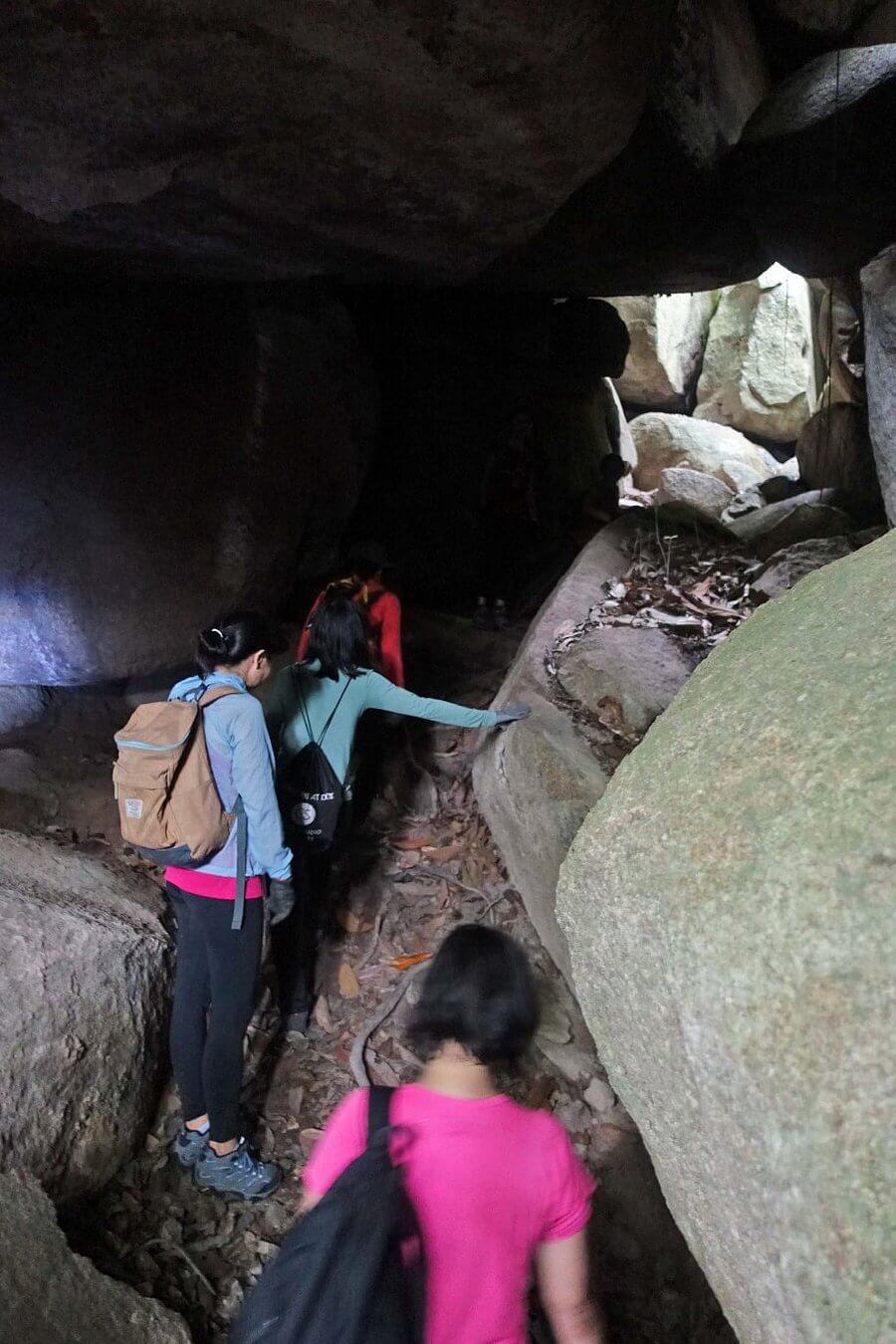
There is a cave that hikers love to drop by, which is toward the end of the right side of the beach. You will have to wander through a rocky area before reaching the cave. That said, do note that the cave serves as more of an archway to frame your photos.
For precautionary measures, I'd advise visiting the cave only during low tide. Don't forget to check the schedule of the tides before searching for the cave, because the high tide makes it dangerous for you to be in the cave.
Entry Fee: RM1
Hiking Time: 30 minutes
Trail Distance: 1.3km
Elevation Gain: 84m
Opening Hours: 7:00 AM to 6:00 PM, daily
Address: Hutan Simpan Tanjung Tuan, 71050, Si Rusa, Malacca, Malaysia
4. Bukit Batu Lebah
Bukit Batu Lebah is one of Melaka's hidden treasures that is simply waiting for you to scale. It is part of a recreational forest is home to hiking activities and cave explorations.
Fun Fact: Did you know that it's name originates from the beehives that were previously present in the caves?
If you are a local looking to improve your hiking stamina as a beginner, Bukit Batu Lebah is a great place to be at. Besides, Bukit Batu Lebah is famous for its unique rock formations with different shapes, ranging from ships to snakeheads to elephants!
There's no ticket price to enter the recreational forest, but you will need to pay a fee for a guide if you intend to hike Bukit Batu Lebah. There are a few trails available that range from 4 to 6 hours of hiking.
Halfway up the hill, you will arrive at a clearing that gives you a great view of the unspoiled nature of Malacca. The clearing offers a better view compared to the peak, as the peak is surrounded by trees.
As the area gets pretty hot in the afternoon, I'd recommend starting your hike around 7:00am just before sunrise to avoid the midday heat.
Hiking Time: 4 to 6 hours
Opening Hours: 9:00 AM to 5:00 PM
Address: Bukit Batu Lebah Recreational Forest, Taman Eko-Rimba, Kampung Bukit Senggeh, 77500 Selandar, Melaka, Malaysia

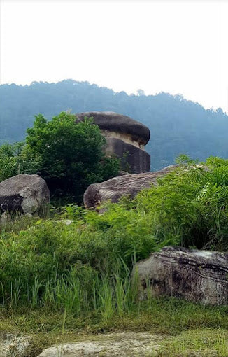
5. Bukit Batu Putih
Surprised to find Bukit Batu Putih here? Bukit Batu Putih is located at Melaka, but parts of the trail cross into the neighbouring state of Negeri Sembilan so you may hear of it being tied to Negeri Sembilan more often than not.
Bukit Batu Putih's scenic trail begins from the parking lot, where you head up the tarmac road until you're almost at the stairs leading to the famous Rumah Api Tanjung Tuan. Look out for the signboard, which leads you to Bukit Batu Putih's hiking trail.
Parts of the trail can be steep, but it'll all be worth it when you reach the peak of Bukit Batu Putih and be in awe of the a 200-million-year-old quartz ridge. Bear in mind that there is a rocky climb towards the final ascent, so you'll want to bring a pair of gloves protect your hands from the naturally rough and sharp nature of the climb.
The surrounding greenery and sea make for a stunning panoramic scenery that will take your breath away so don't forget to bring a fully charged smartphone to capture away! You can also spot the lighthouse from the peak and get a lovely snap of it.
It's best to hike early in the morning to avoid the scorching sun in the middle of the day. It may also be crowded during the weekends as many locals like to hike the hill to enjoy and take a picture or two of the spectacular view.
Entry Fee: RM1
Hiking Time: 1 hour 21 minutes
Trail Distance: 3.9km
Elevation Gain: 194m
Opening Hours: 8:00 AM to 6:00 PM, daily
Address: Puncak Bukit Batu Putih, Tanjung Tuan, Melaka, Malaysia

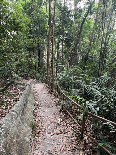
6. Hutan Simpan Tanjung Tuan
Hutan Simpan Tanjung Tuan, also known as Tanjung Tuan Recreational Forest, is Melaka's nature preserve with certain areas extending past the Malacca border into its neighbouring state, Negeri Sembilan.
One of Malaysia's most famous lighthouses can be found at Hutan Simpan Tanjung Tuan - Cape Rachado Lighthouse trail. The lighthouse was built to guide the ships through the Straits of Malacca, but its doors are now closed to the public. Even so, you can still towards the vicinity of the lighthouse for a closer view and feel of the place.
Apart from the famous lighthouse, Hutan Simpan Tanjung Tuan has some of the best hiking trails in Melaka for you adventurous hikers to explore!
For those looking for spectacular views, opt for the Bukit Batu Putih route! It's a popular trail where you hike through the forest and climb a rocky area to the top, where you can admire a gorgeous view of the ocean and the rainforests.
The Monkey Bay trail is another great option, especially if you wish to challenge yourself. This trail takes you through the jungle trek until you arrive at the beach, followed by a steep hike to the peak of Bukit Batu Putih. Do note that it's best to check online for the high tide times on the day you decide to hike because it is not safe to use the beach route during high tide.
If you're interested in another moderately challenging route, the Dutch Well Trail is another excellent option. As you trek through the forest, you will see the Dutch well surrounded by dense vegetation. As you walk ahead, you will also come across a pair of footprints, which allegedly belong to the heroic Malay warrior, Hang Tuah. Apparently, the trail has a few gazebos along the way where you can sit and take a break as you catch your breath. Eventually, the trail leads to a beach where you can relax or go for a swim.
Aside from its hiking trails, Hutan Simpan Tanjung Tuan is also famous for its annual bird-watching event, the Raptor Watch. The event is typically held for a weekend during March, where you can spot birds such as the Grey-faced Buzzard, the White-Bellied Sea Eagle, the Coppersmith Barbet, and the Oriental Honey Buzzard! How awesome is that?
Entry Fee: RM1
Hiking Time: Up to 1 hour 41 minutes
Trail Distance: Up to 5.6km (longest trail)
Elevation Gain: 194m
Opening Hours: 8:00 AM to 6:00 PM, daily
Address: Jalan Pantai, Tanjung Tuan, 71050, Melaka, Malaysia

7. Gunung Tampin Selatan - Gunung Tampin Utara Hiking Trail
Although Gunung Tampin is located in Negeri Sembilan, the mountain's location sits along the border of Melaka. Which is why I simply couldn't write this article without skipping Gunung Tampin!
For adventurous hikers, Gunung Tampin is definitely the route for you - it's where you will conquer 2 peaks within the same day.
To get to the entrance of the trail, you need to go up a 4km tarmac trail until you see the Telekom towers. Many people like to drive their cars and park near the Telekom towers for a shorter walking time. But keep in mind that Gunung Tampin is a popular hiking spot, so it may be hard to get a parking spot. Alternatively, you can always opt for the 4km walk on tarmac ground to challenge yourself!
Be on the lookout for a flight of stairs going down, which is where the trail to Gunung Tampin Selatan begins. If you parked your car where the Telekom towers are, head downhill a little to find the stairs. If you plan to walk up the tarmac road, you will see the flight of stairs before reaching the Telekom towers.
As the trail is rather slippery and infested with leeches in certain areas especially in the middle of wet seasons, proper hiking shoes with a good grip and anti-leech socks will help ease your climb to the two peaks.
Entry Fee: RM5 (permit)
Hiking Time: 4 hours 50 minutes
Trail Distance: 11.7km
Elevation Gain: 793m
Opening Hours: 24 hours, daily
Address: Gunung Tampin, 73000, Tampin, Negeri Sembilan, Malaysia
8. Gunung Ledang - Asahan Trail
Does Gunung Ledang sound familiar?
It's the very same mountain in the story where the Sultan of Malacca proposed to the princess of Gunung Ledang during the era of the Malacca Sultanate. Whether the folklore is true or fable, Gunung Ledang, also known as Mount Ophir, is the real deal and it's ready for you to climb!
Gunung Ledang's Asahan Trail is a challenging route, so it's best attempted only by experienced hikers. Due to the high difficulty of the route, a good pair of hiking shoes and a hiking stick are a must to assist your climb to the top. On top of that, you will need a permit and a guide to hike Gunung Ledang.
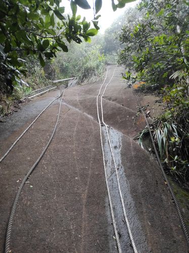
Steep slopes are present throughout, along with 2 rock facades (one has an incline of almost 80 degrees!) with rope sections and rickety ladders as you get closer to the peak. Come prepared with gloves to get a good grip on the ropes and ladders, especially when it is wet and slippery. A raincoat will also come in handy in case of rain to reduce your chances of getting a cold while hiking.
Many hikers like to opt for a 2-day-1-night hike so they can enjoy the sunrise from the peak. But if you are looking for a challenge, it is possible to do a day hike at Gunung Ledang.
There are several checkpoints throughout the route. The 3rd checkpoint is infested with leeches, so it's best to keep moving. On the other hand, the 6th checkpoint has a campsite, a toilet, and a waterpoint available.
As it will be a long hike, don't forget to bring up to 2L of water in your Montigo Ace Bottle Massive to stay hydrated along with some snacks and onigiri or sandwiches to eat along the way to replenish your energy.
Once you've conquered all the challenges thrown at you by Gunung Ledang, what awaits you at the peak is a dazzling panoramic scene of green pastures. The peak is thankfully rather spacious, making it perfect for you to take a break with a mini picnic before descending.
One thing to keep in mind is how you will be requested to list down the items you're bringing with you up to Gunung Ledang. Remember to pack all your items and rubbish together because you will be fined a hefty sum if any items are missing from the list. This rule is there simply to ensure that hikers do their part in keeping the legendary mountain rubbish-free.
Hiking Time: 2-day-1-night hike or 1-day hike of 8 to 10 hours
Trail Distance: 12.2km
Elevation Gain: 1,334m
Opening Hours: 24 hours, daily
Address: Jalan Kolam Air Asahan, 77100 Jasin, Melaka, Malaysia

9. Bukit Gapis
As a newer hiking location, Bukit Gapis might seem like a forgotten hiking spot in Melaka. However, Bukit Gapis is the tallest hill in Malacca for hiking enthusiasts to conquer. It is considered an easy to moderately challenging route that is not known to many hikers for the time being. Hence, you may not meet many people along the way.
The trail begins at a rubber estate, where you'll begin walking until you reach a river. After crossing the river, you will encounter several checkpoints before arriving at the peak.
When you reach the top, look out for the boundary stone that shows where Melaka and Negeri Sembilan are, which is believed to have been built by the British during the colonisation days.
However, the top of Bukit Gapis isn't very spacious, which makes it less convenient to take photos of the surrounding scenery, especially if there are many people at the top.
Since you'll need a guide to lead you up the hill, do contact Bukit Gapis (Gunung Melaka) on Facebook to find out more about getting the right guide for you or your hiking group. Do note that you'll also need to obtain a permit from Jabatan Perhutanan Negeri Melaka in advance.
Entry Fee: RM5 (permit) + RM2 (parking)
Hiking Time: 2 hours 35 minutes
Trail Distance: 5.3km
Elevation Gain: 470m
Address: Kampung Gapis, 77100 Pekan Asahan, Malacca, Malaysia